Aerial winter view of a winding road crossing a snow-covered landscape, between forests and hamlets

Mapping

From data to modelling: Abest orchestrates every stage to bring projects to life

WW

What we offer

From on-site measurement through to the production of technical or communication visuals, for all types of regions and all types of clients.

From data to image

Topographic total station on a tripod facing a landscape of hills, illustrating an outdoor land survey
3D illustration of the layered tiers of a Geographic Information System: land registry, contour lines, orthophoto and hypsometry
Coloured ground markings on a carriageway for utility detection and the location of underground networks
Kaliblue
Kaliblue
3D aerial view of the village of Les 2 Alpes set within its summer mountain surroundings
Topographic total station on a tripod facing a landscape of hills, illustrating an outdoor land survey

Measuring the region

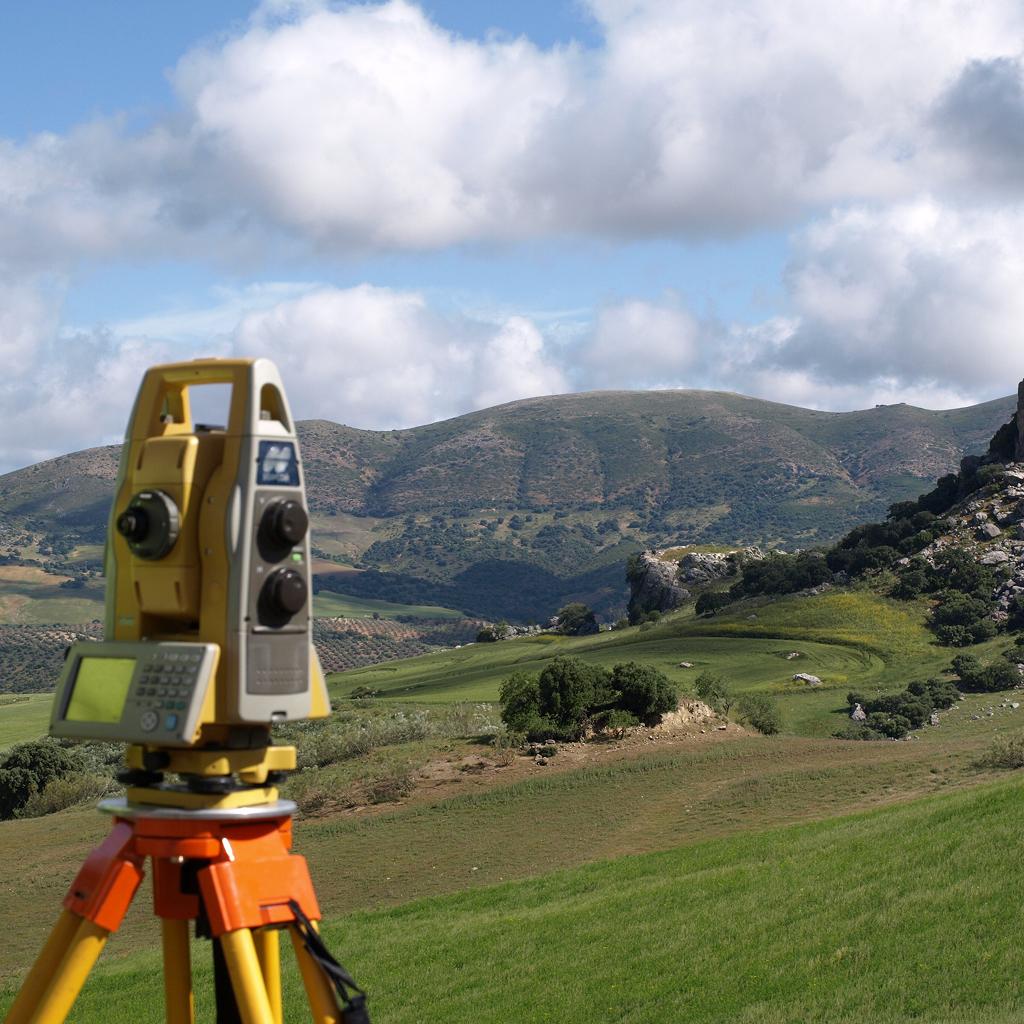
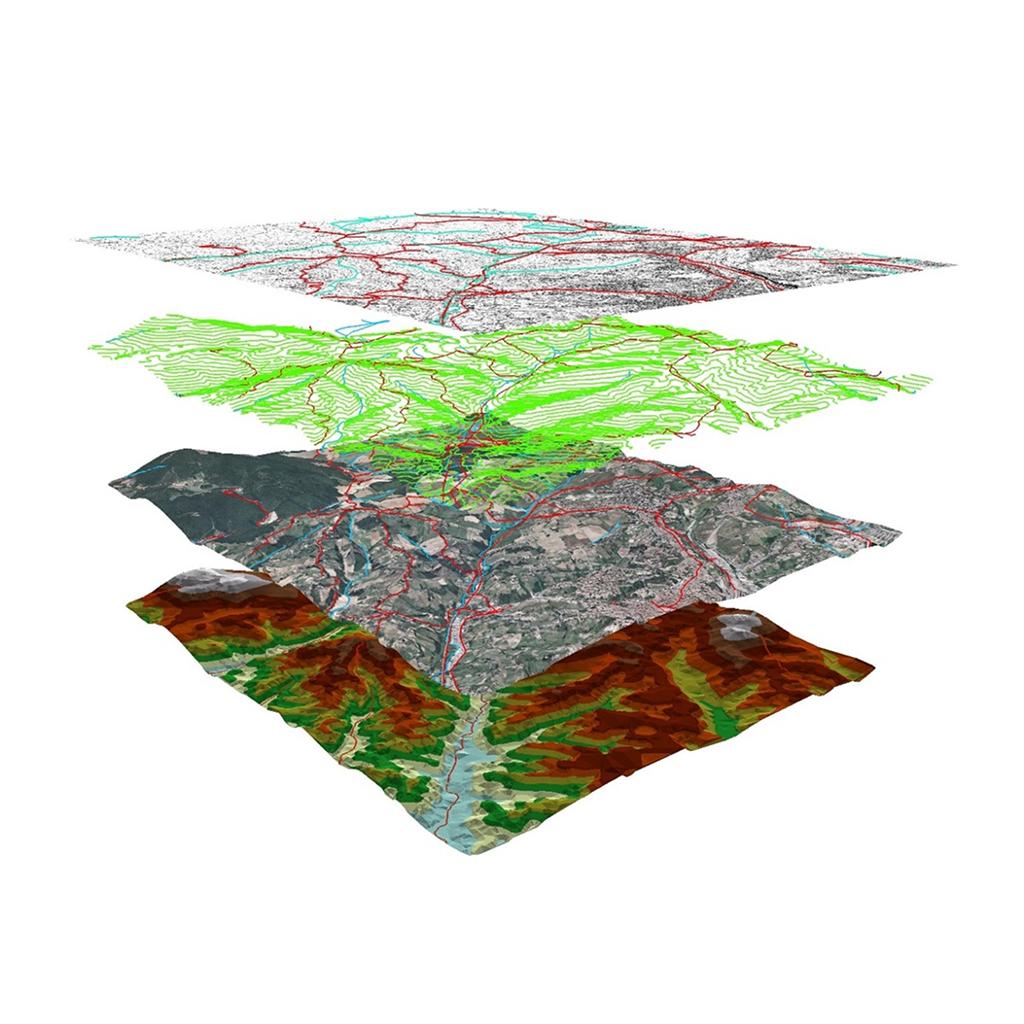
Orthophotos, ground surveying using differential GPS and total station, drone photogrammetry, Lidar, digital terrain models (DTM, DSM, DEM). Accuracy from pixel to metre as required.

3D illustration of the layered tiers of a Geographic Information System: land registry, contour lines, orthophoto and hypsometry

Geographic Information Systems (GIS)

Turnkey GIS solutions with sector-specific configuration: ski area, municipal technical department, tourist office, fire service. Géoconcept and IntraGéo reseller. Database training, integration and maintenance.

Coloured ground markings on a carriageway for utility detection and the location of underground networks

Utility detection and networks

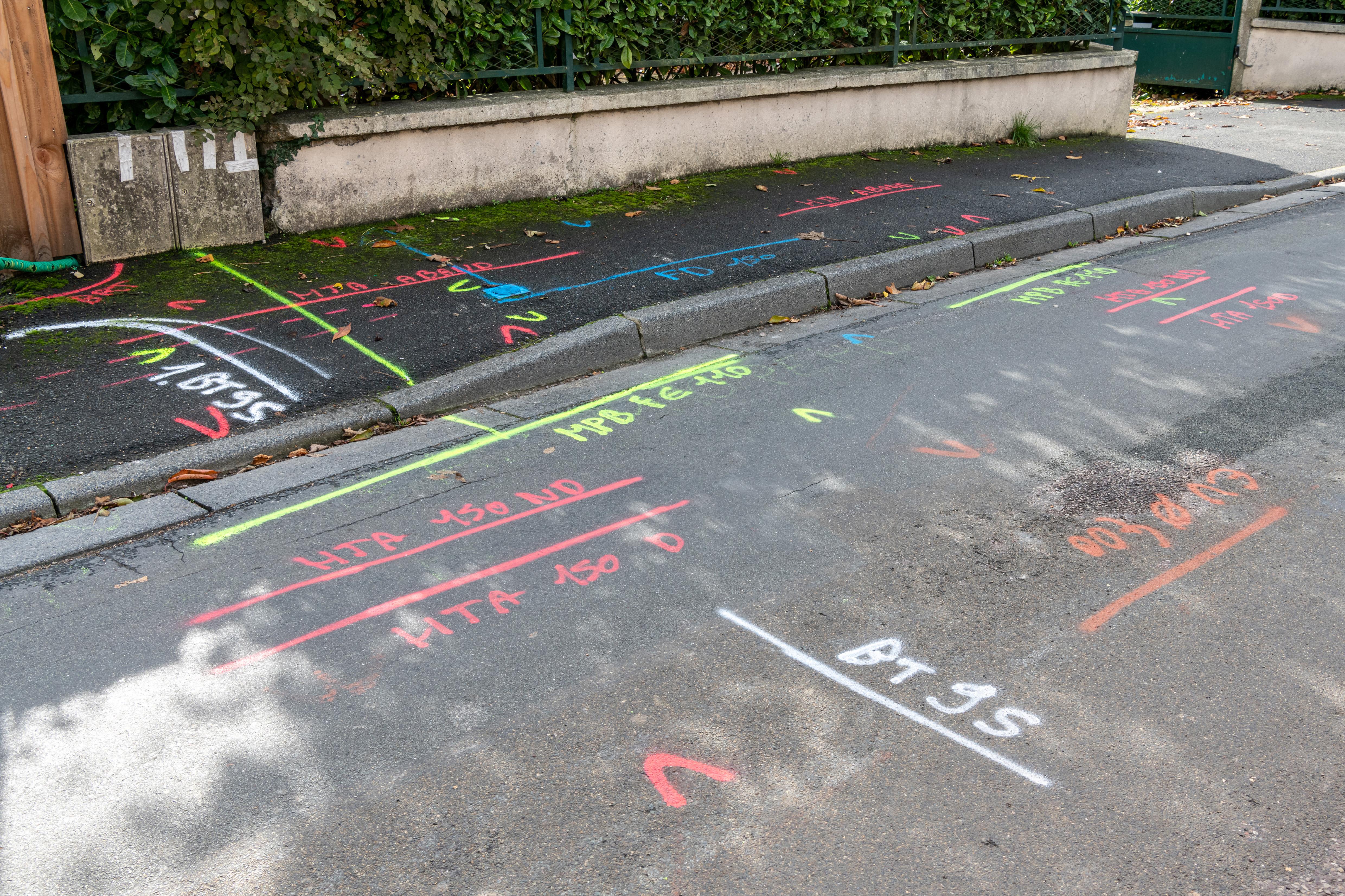
Detection and identification of all types of buried networks (dry and wet utilities). Marking and staking, post-works as-built surveys, asset mapping. MASE certification. Member of the FNEDRE.

Kaliblue

3D modelling and drone imagery

Promotional films, event videos, project integration onto real-life footage. Modelling of resorts, buildings, ski lifts and development projects. Certified drone pilots.

Kaliblue

Resort maps and artistic cartography

Alpine and nordic piste maps, walking and mountain-biking trail maps, summer and winter village maps. Produced from digital terrain models, with high-definition georeferenced vector layers (up to 20,000 pixels per side).

3D aerial view of the village of Les 2 Alpes set within its summer mountain surroundings

Graphic design and project visualisation

Still and animated project visualisations, panoramas, Géovolum' resin models, georeferenced plans. From A4 format to large-format panels, from technical rendering to public-facing communication.

OO

Our Mapping expertise

20 years of leadership in 3D mapping and the modelling of mountain resorts, now reinforced by the strength of a multi-entity group.

Excellence in data, precision in the field, refinement in modelling

Graphic motif of black topographic contour lines on an ochre background

GIS data management

Creation and updating of geomatics systems

Surveying, structure monitoring

Ground and aerial surveying. Network georeferencing. Setting-out, as-built surveys (open trench), structure monitoring.

Utility detection, network georeferencing

Additional investigations. Marking-and-staking location operations. Asset mapping. Post-works as-built surveys by detection.

Modelling, drone imagery and 3D scanning

3D modelling. Resin models. Drone imagery.

View projects

Graphic design, project visualisation and digital videos

Piste maps, footpath maps, mountain-biking trail maps. Varied graphic design. 3D project videos.

View projects
BB

By the numbers

Geomatics systems created and updated

850+

Kilometres per year of georeferenced and mapped networks

500

Years of leadership in projection and 3D modelling technologies

20

Resort and project maps

620+

II

In their words

Meet the team
Portrait of an ABEST team member

“Regions are constantly changing. Integrating collective memory into a GIS makes it possible to work with precision, quality and safety, while meeting new collaborative needs.”

Olivier Mermillod — Head Cartographer

Portrait of an ABEST team member

“Surveying is a key stage, capturing the state of the ground at a given moment. It is one of the fundamental building blocks for project design.”

Christophe Feraud — Land Surveyor/Detection

Portrait of an ABEST team member

“I structure field data to integrate it into clients' databases, ensuring its quality, its compatibility and reliable information across all networks.”

Xavier Marchetti — Head of Mapping